
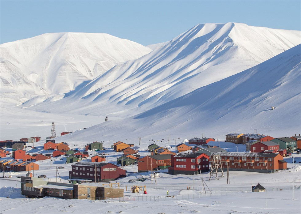
After flying into Longyearbyen from Oslo, a short city tour will introduce you to the fascinating history and contemporary society of Svalbard's capital.– It may be the northernmost “real” town in the world.
Our boat was moored at the marina near the city center. After embarkation and a welcome drink, the expedition leader will provide information about the voyage, the daily routine of the ship and various safety and security procedures. Before sailing, mandatory safety drills are conducted. Then the captain drove the boat out of Advent Fjord, and our Arctic adventure began.
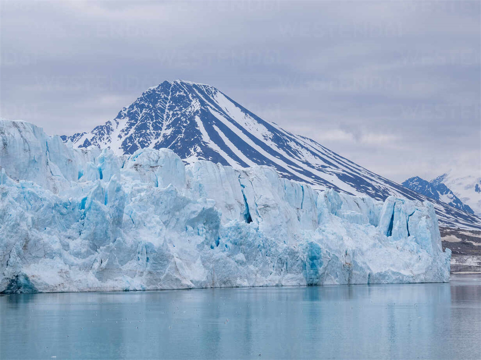
exist"At night", we passed Prince Karls Volland Island and came to the magnificent Kongsfjord. Our trip to Svalbard was at the beginning of summer, which was both a challenge and a gift on this particular voyage. Winter ice may clog the interiors of many fjords, but this will give us our best chance of observing the ubiquitous but still elusive polar bears, which hunt seals in their primary habitat. This time of year the migratory birds are just arriving. They are all eager to settle in and prepare food for the busy summer ahead.
The first land point we will come to is Ny-Alesund: the northernmost town in the world, where the northernmost series of post offices, museums, and galleries are located; the entire town is aboutThere are more than 60 houses for tourists and scientific expedition personnel. Although there are no permanent residents, there are post offices, bars, small supermarkets, docks, airports, etc.; the town is the most important international Arctic research center. Every summer, about 100 scientists from multiple countries gather here to study various topics from microorganisms to climate. It is like a small United Nations.
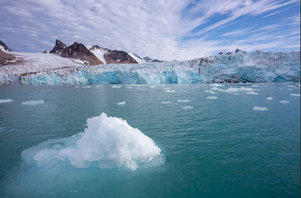
In the afternoon we continue north into the fjord system and depending on ice conditions we may followTake a cruise along the Lilliehöök glacier front or attend a lecture.
Lilliehook Glacier:north latitude79°31′, longitude 11°60′; in 1906, Prince Albert I of Monaco arrived here to conduct scientific research to study how Arctic clams could survive on the earth for more than an entire century. By observing the stripes on Arctic clam shells, scientists can infer the impact of seawater temperature and pollutants on Arctic glaciers and changes in icebergs.
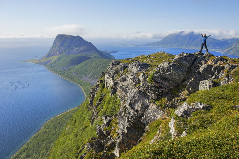
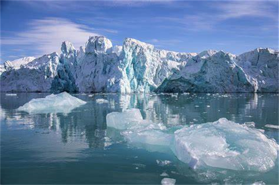
Alkfjellet: Also known as "Puffin Mountain" and "Seabird City"; 79°44′ north latitude, 18°78′ east longitude, facing Isfjorden (Isfjord). It is one of the most spectacular bird cliffs in Svalbard. You can watch all kinds of birds thrive here at close range. The front of the cliff is composed of basalt pillars rising from the water, with a vertical height of more than 100 meters and a width of several kilometers; about 100,000 pairs of thick-billed puffins live here. They lay eggs and incubate their offspring on the bare and steep rock walls, but do not build nests. The eggs exposed among the rocks become the most delicious meals for various animals; groups of seagulls look for food here, and Arctic foxes and polar bears often wait here for delicious food falling from the sky.
Now entering the northwest of Svalbard, it is inIt was declared a national park in 1973. The day can start with a slow cruise in Danskgat, search for seals in Vilgohanna, and then from Dansk to Amsterdam Island, landing in the legendary 17th-century whaling town of Smeerenberg. At the height of blubber production, more than 200 people lived and often died here. There are several interesting places to visit in the northwest corner of Spitsbergen.
If conditions permit, we will land on the island of Noskja, where there is a whalers' lookout.
At night, the ship will sail to the edge of the polar ice floe. This is the kingdom of polar bears!As the ice floes recede in the summer, polar bears move north along the ice floes because this is where their prey, the seals, live. If the bear is unlucky and doesn't "catch" the ice moving north, it will be stuck on Svalbard all summer, having to survive on berries, eggs and any whale carcasses they can find. A hard life indeed!
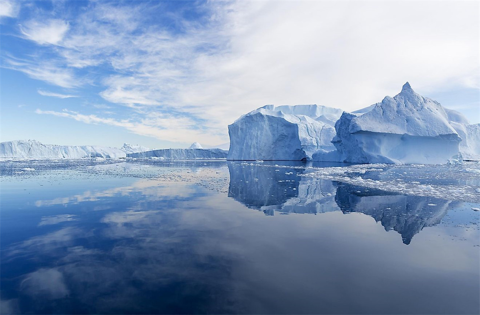
Today's voyage is planned to cross the North Atlantic and the Greenland Sea. While sailing southward in the historic Greenland Sea, you can participate in various activities organized on the ship. Our expedition team lecturers will give special introductions to the geography and history of the Svalbard Islands, Greenland, and Iceland, natural landscapes, wildlife, climate conditions, etc.; you can also come to the deck to capture and photograph various seabirds unique to the Arctic region, leaving precious image data; you can also drink an ice cocktail at the bar or share photos with everyone.……
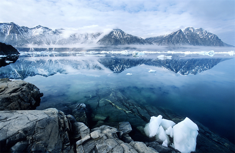
Today's voyage is planned to cross the North Atlantic and the Greenland Sea. While sailing southward in the historic Greenland Sea, you can participate in various activities organized on the ship. Our expedition team lecturers will give special introductions to the geography and history of the Svalbard Islands, Greenland, and Iceland, natural landscapes, wildlife, climate conditions, etc.; you can also come to the deck to capture and photograph various seabirds unique to the Arctic region, leaving precious image data; you can also drink an ice cocktail at the bar or share photos with everyone.……
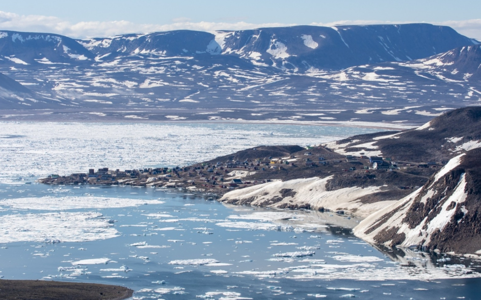
We'll search for wildlife along ice floes and cruise into fjords in some of Northeast Greenland's most unique and unspoiled natural environments. we will try tobear islandandbrewster pointLogin. Brewster Point isIn 1822, William Scoresby named the headland Brewster Point in honor of his friend and inventor David Brewster (1781-1868). This is the easternmost point of the jagged and mountainous Savoia Peninsula and the northernmost point of the Broseville Coast, a wild and impressive area with steep black basalt walls 1,000 to 2,000 meters high.
Afterwards we will visitittoqqortoormiitsettlement,ittoqqortoormiit means "big house dweller" in the East Greenland dialect. It used to be calledScoresbysund (Scoresbysund), the name comes from the British Arctic explorer and whalerWilliam Scoresby, who was the first European to map the area in 1822. With just 470 residents, it is one of the most remote towns in Greenland, accessible only by a short helicopter and boat ride in the summer. The town is located in Scoresbysson, the longest fjord in the world.
Scoresbysund (Scoresbysund):This is the birthplace of many icebergs and the most beautiful fjords in the world; countless fjords gathered here are filled by huge glaciers and extend to the edge of the inland ice sheet. The vast fjords and basalt cliffs are breathtaking. We hope to be able to offer kayak cruises and landings, weather and ice conditions permitting.
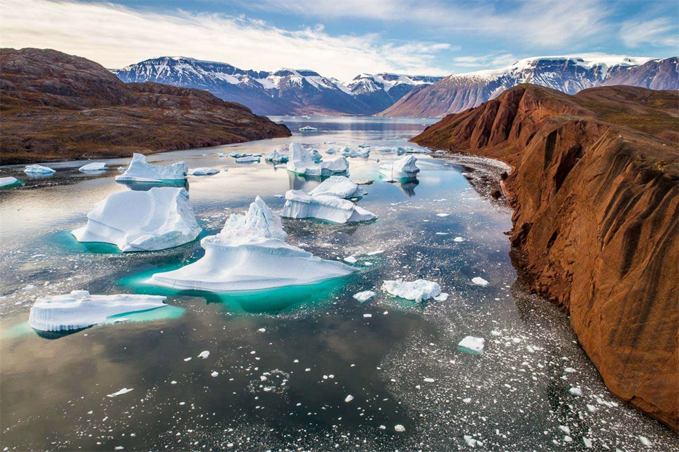
We'll search for wildlife along ice floes and cruise into fjords in some of Northeast Greenland's most unique and unspoiled natural environments. we will try tobear islandandbrewster pointLogin. Brewster Point isIn 1822, William Scoresby named the headland Brewster Point in honor of his friend and inventor David Brewster (1781-1868). This is the easternmost point of the jagged and mountainous Savoia Peninsula and the northernmost point of the Broseville Coast, a wild and impressive area with steep black basalt walls 1,000 to 2,000 meters high.
Afterwards we will visitittoqqortoormiitsettlement,ittoqqortoormiit means "big house dweller" in the East Greenland dialect. It used to be calledScoresbysund (Scoresbysund), the name comes from the British Arctic explorer and whalerWilliam Scoresby, who was the first European to map the area in 1822. With just 470 residents, it is one of the most remote towns in Greenland, accessible only by a short helicopter and boat ride in the summer. The town is located in Scoresbysson, the longest fjord in the world.
Scoresbysund (Scoresbysund):This is the birthplace of many icebergs and the most beautiful fjords in the world; countless fjords gathered here are filled by huge glaciers and extend to the edge of the inland ice sheet. The vast fjords and basalt cliffs are breathtaking. We hope to be able to offer kayak cruises and landings, weather and ice conditions permitting.
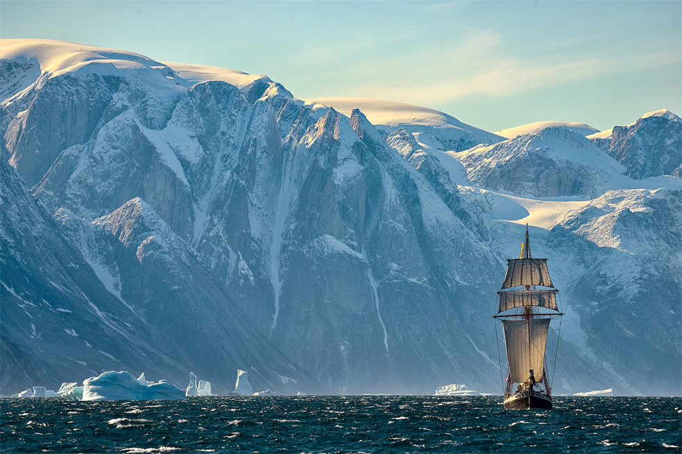
BlossevilleBlosseville CoastPossibly the most dramatic coast outside the Arctic, it's protected by Greenland's highest mountains and steepest fjords, and before global warming, a band of floating ice would have shut out all explorers. Over the past decade, summers have been getting warmer and there is less ice, allowing ice-resistant vessels like ours to explore along the coast in search of stunning wildlife, abandoned Inuit settlements and extraordinary scenery.
Our tribute to Iceland and its capitalDeparture from Reykjavík.
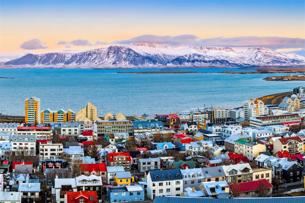
Today's voyage plan will cross the Denmark Strait and sail to Iceland and its capital.ReykjavíkReykjavik. While sailing southward on the historic Greenland Sea, you can participate in various activities organized on board. Our expedition instructors will give special introductions to the geographical history, natural landscapes, wildlife, climate conditions, etc. of Svalbard, Greenland, and Iceland. You can also come to the deck to capture and photograph various seabirds unique to the Arctic region, leaving precious image data. You can also drink an ice cocktail at the bar or share photos with everyone.……
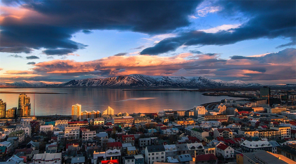
In the early morning, the Ocean Albatros docked at the port of Reykjavik and said goodbye to all the crew and expedition members.
Seat selection and payment instructions
1. Applicable seating range
"Preferred seats" usually refer to the front row area in the bus compartment (specifically based on the actual seat distribution on the bus that day). These seats enjoy a wider field of view, a more convenient boarding and alighting experience, and a relatively comfortable riding space.
2.Charging standards
(1) Itinerary of 8 days or less: USD 12/person/day
(2) Itinerary of more than 8 days: USD 15/person/day
The fee will be calculated on a daily basis based on the total number of days of the trip and will be charged once upon registration.
3. Reservation rules
(1) Voluntary choice: All tour participants can voluntarily choose whether to purchase preferred seat services when registering based on their own needs.
(2) First-come-first-served: The number of preferred seats is limited. Usually for models with 15 seats or above, the first three rows belong to the paid area. Confirmation is based on payment order, while stocks last.
(3) Priority for traveling together: If traveling companions (same order) need to book preferred seats at the same time, we will try our best to arrange adjacent seats.
4. Precautions
(1) The preferred seat fee does not include any other service content, but only the priority of seat location.
(2) If the car needs to be replaced due to weather, road conditions, vehicle scheduling, etc., we will try our best to provide a seat arrangement of equal value or refund the corresponding fee based on the actual number of days affected.
(3) For passengers who have not purchased this service, we will allocate other seats for free in rotation order, and try to ensure that the seats of traveling companions are adjacent to each other.
5.Refund policy
(1) If the order is canceled more than 7 days before the start of the trip, the preferred seat fee will be fully refunded;
(2) If canceled 3-7 days before the trip, 50% of the fee will be refunded;
(3) If canceled within 3 days before the trip, no refund will be given.
Itinerary instructions
Special instructions:
1. The above itinerary sequence, attractions, flights and accommodation locations may be temporarily changed, modified or replaced. The final itinerary is subject to the itinerary confirmed by our company before departure;
2. Our company reserves the right to change the itinerary and add price differences due to factors such as airlines, visas, governments, weather, etc.;
3. The flight numbers and times listed in the itinerary are for reference only, and reasonable adjustments will be made based on the actual situation;
Travel information
1. Gathering and boarding requirements
(1) All tour group members must gather on time and depart on time. Please arrive at the pick-up location 15 minutes in advance. Our company's tour bus will not wait. If you fail to gather and set off at the agreed time and location, or fail to join midway, you will be deemed to have given up automatically and the fee will not be refunded.
(2) The pick-up and drop-off times stated in the tour notice are all estimated times, and the specific pick-up and drop-off locations are subject to confirmation by the company. If due to traffic conditions or other special circumstances, our company's bus cannot arrive at the boarding location on time or the time is temporarily changed, our company will notify you in time, so please be patient.
2. Vehicle and luggage requirements
(1) Passenger buses are divided into three types: buses, minibuses and minibuses. Generally, buses have luggage compartments dedicated to storing luggage, while minibuses and minibuses have relatively smaller spaces for luggage storage. In view of the limited space in the luggage compartment of the bus, it is recommended not to carry too much luggage when traveling. Our company will arrange vehicles according to the final group size, ensuring one person per person.
(2) In order to avoid overcrowding in front of the scenic spots, the bus parking areas in most cities are far away from the scenic spots, and drivers are not allowed to park casually. Violators will be subject to heavy fines. If necessary, the pick-up and drop-off location may be some distance away from the attraction. Please understand.
3. Safety tips for taking a bus
(1) Smoking in the car is prohibited.
(2) Please do not bring prohibited items.
(3) Do not fiddle with anything on the car at will to avoid unnecessary damage.
(4) During the temporary stop of the bus, obey the tour guide’s arrangements and do not stay away from the group.
(5) When group members get off the bus for sightseeing, dining, or shopping, please close the windows of the tour vehicle and carry your valuables with you. The travel agency is not responsible for any loss or theft.
(6) Due to the long journey time and heavy vehicle loads, if the car breaks down and affects the itinerary, the travel agency will quickly take remedial measures and ask the group members to actively cooperate.


